Severe Weather Risk Raised To High
The National Storm Prediction Center (SPC), in coordination with the National Weather Service Field Office in Birmingham has raised the risk level for severe storms and tornadoes Saturday to HIGH.
To give some perspective to the significance of this, the last time the highest risk level was issued for West Alabama was April 27, 2011, one of the fiercest outbreaks of severe thunderstorms and tornadoes in U.S. history.
On the scale from one to five, a high risk is a level five; thus, high risks are issued only when forecasters at the SPC are confident of a major severe weather outbreak. According to SPC criteria, this is usually for major tornado outbreaks with numerous strong to violent tornadoes expected, and occasionally derechos with widespread destructive wind gusts, and these outlooks are typically reserved for the most extreme events.
High (5 in 5) Risk days are extremely rare. There have been only two issued since 2000 in the United States.
According to the SPC, 2.7 million people live in the high-risk area that encompasses such cities as Tuscaloosa, Birmingham, Jackson, MS. and Hattiesburg, MS.
In its afternoon Convective Outlook, the SPC wrote, "(The) level 5-HIGH risk appears warranted for the most likely corridor of potentially violent tornadoes, peaking tomorrow afternoon and evening. A broader level 4-MDT risk has been expanded somewhat eastward for the nocturnal significant tornado threat."
SPC further stated that "numerous significant tornadoes, some of which should be long-track and potentially violent, are expected on Saturday afternoon and evening."
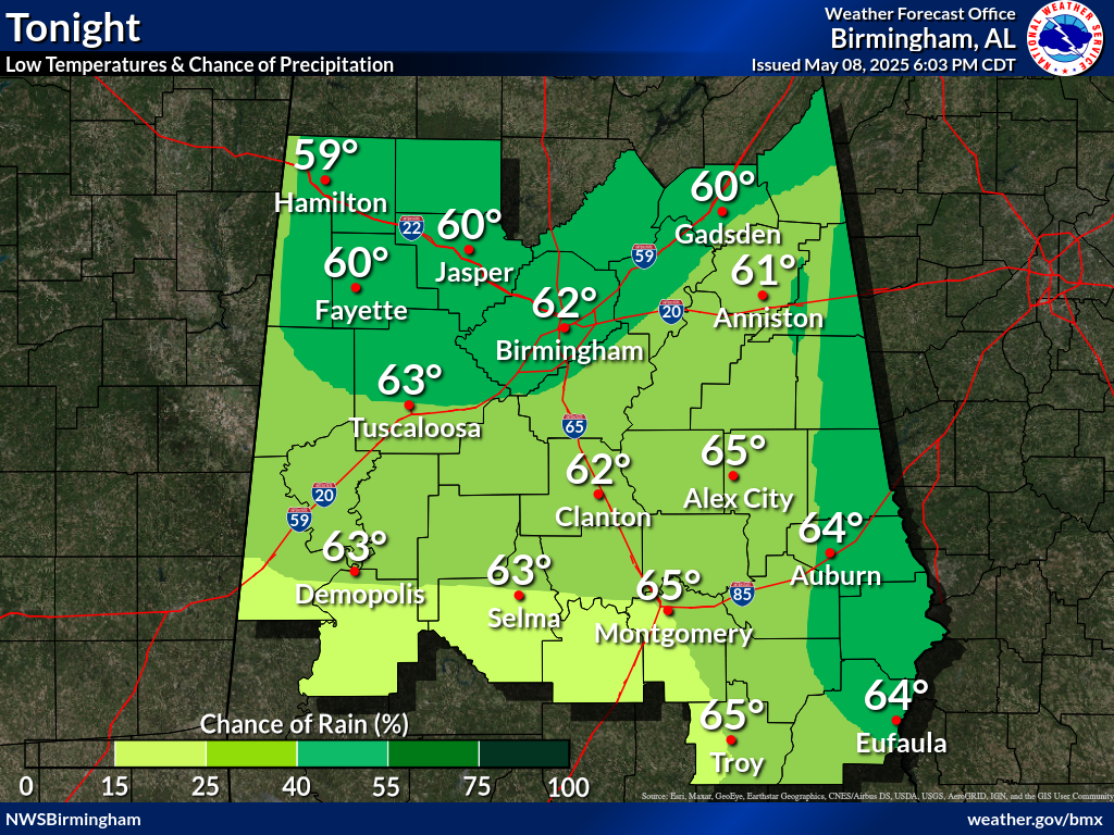
A Moderate (3 in 5) Risk for tornadoes, 60mph wind gusts and quarter size hail continues for tonight beginning around 7:00pm ending around 8:00am Saturday morning.
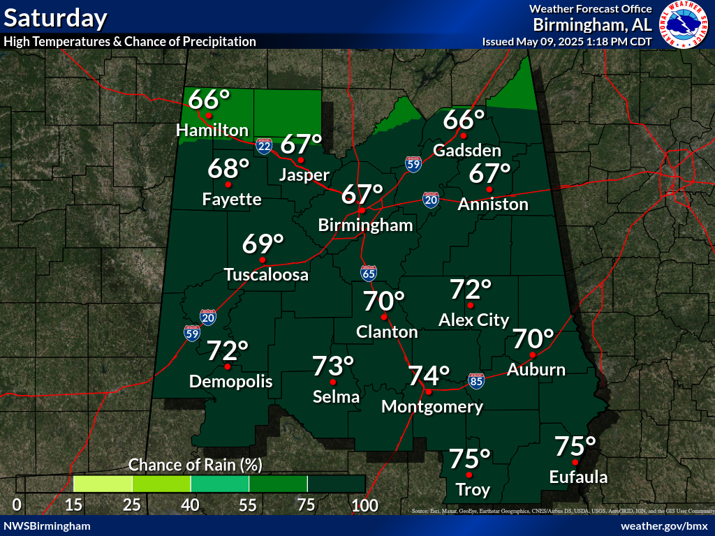
Saturday's timeline has the threat to West Alabama beginning at noon and ending around 9:00pm as the storm moves toward the I65 corridor.
A Wind Advisory will also be in effect between 7:00am Saturday and 1:00am Sunday.
A Flood Watch will be in effect for Lamar, Fayette and Walker counties Saturday morning through late Saturday night.
This is a dangerous situation that bears monitoring for later updates and possible warnings on TuscaloosaThread.com and via Operation Storm Watch on all of the Townsquare Media Tuscaloosa radio stations.
Be sure you have a reliable way to receive warnings overnight, while you sleep. Do not depend on outdoor warning sirens since they are made for alerting outdoors only.
More From 95.3 The Bear