
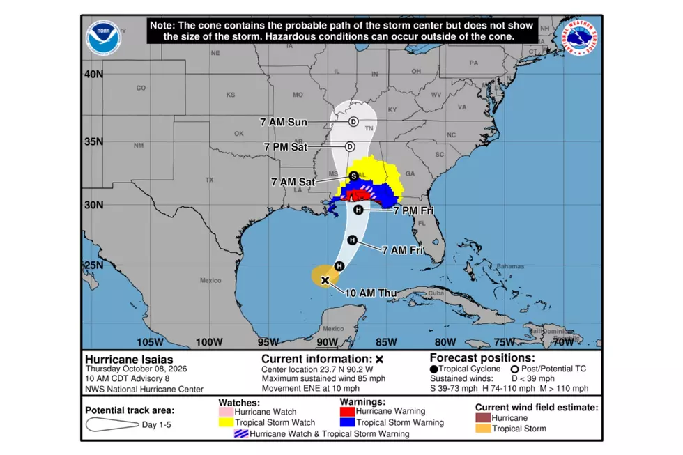
Tropical Storm Watch Issued for a Portion of West Alabama
The National Weather Service in Birmingham has issued a Tropical Storm Watch.
This means tropical storm-force winds are possible somewhere within the watch area within the next 48 hours.
West Alabama Counties Under the Tropical Storm Watch
Bibb
Greene
Hale
Perry
Sumter
Tuscaloosa

READ MORE: Isaias Is Now a Hurricane: West Alabama and Gameday Outlook
WIND OUTLOOK
LATEST LOCAL FORECAST: Below tropical storm force winds
Peak Wind Forecast: 20-30 mph with gusts to 50 mph
THREAT TO LIFE AND PROPERTY THAT INCLUDES TYPICAL FORECAST UNCERTAINTY IN TRACK, SIZE AND INTENSITY: Potential for wind 39 to 57 mph
PLAN: Plan for hazardous wind of equivalent tropical storm force.
PREPARE: Efforts to protect property should now be underway. Prepare for limited wind damage.
ACT: Act now to complete preparations before the wind becomes hazardous.
POTENTIAL IMPACTS: Limited
- Damage to porches, awnings, carports, sheds, and unanchored mobile and manufactured homes. Unsecured lightweight objects blown about.
- Many large tree limbs broken off. A few trees snapped or uprooted, especially weaker trees. Some fences and roadway signs blown over.
- A few roads impassable from debris, particularly within urban or heavily wooded places. Hazardous driving conditions on bridges and other elevated roadways.
- Scattered power and communications outages.


