Tropical Storm Likely to Bring Storms, Flooding Across Alabama
A tropical storm forming in the Gulf Coast is projected to bring rainfall across Alabama, with the potential of flooding in areas across the state beginning Wednesday.

The National Weather Service in Birmingham said "a frontal boundary will move through the area Wednesday afternoon through the overnight hours. Scattered showers and thunderstorms are possible along this front, with heavy rainfall anticipated."
James Spann, ABC 33/40, and Townsquare Media Tuscaloosa Chief Meteorologist said "scattered to numerous showers and storms are likely statewide, mostly during the afternoon and evening hours."
The NWS said the storms are not considered hazardous but could cause localized flooding. The greatest chance of activity is expected for the southeastern half of the state but is possible across Alabama.
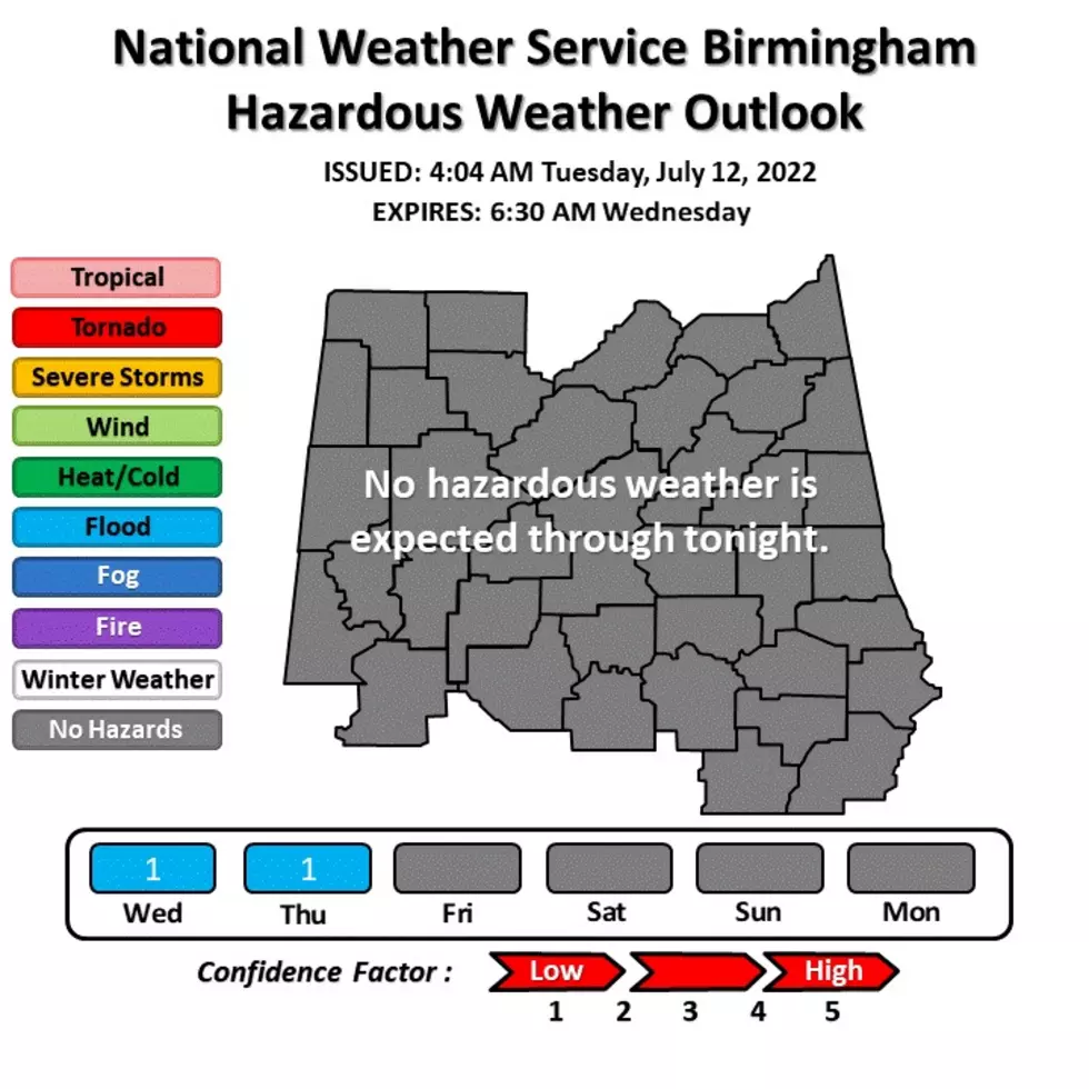
Notes from National Weather Service in Birmingham
- All of central Alabama
- Wednesday and Thursday
- Localized Flooding
In the event of severe weather, we will provide updates for the counties in the Townsquare Media listening area.
Counties we cover
Bibb
Fayette
Greene
Hale
Lamar
Perry
Pickens
Sumter
Tuscaloosa
Walker
(Source) Click here to follow the Facebook Page for James Spann. For more from the National Weather Service Birmingham, click here.
Top Stories from the Tuscaloosa Thread (7/4 - 7/11)
More From 95.3 The Bear