Fred Trends Westward, Increasing Rain Chances in Tuscaloosa, Alabama
As we suspected, the track and forecast of Fred have certainly changed a few times. Fred has weakened, which means the system is an open wave. However, some restrengthening is likely.

As we suspected, the track and forecast of Fred have certainly changed a few times. Fred has weakened, which means the system is an open wave. However, according to the National Weather Service Birmingham, “some restrengthening is likely, and Fred is forecast to re-develop into a tropical storm before it makes landfall. Uncertainties in the track and intensity remain.”
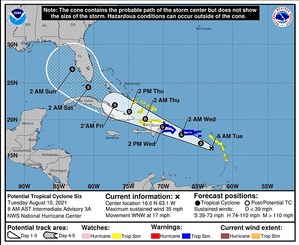
The cone of uncertainty as shifted has Fred has trended in a westward direction. This means that landfall could take place between Panama City, Florida, and Biloxi, Mississippi. We will continue to monitor this system for any potential impacts to our coverage areas.
Impacts for Central Alabama from the National Weather Service Birmingham:
Wind:
- What: Breezy winds with gusts of 30-35 mph
- Where: Mainly across the south
- When: Tuesday
Flooding:
- What: Increasing threat of heavy rainfall, but widespread flooding is not anticipated at this time
- Where: Much of Central Alabama
- When: Monday night and Tuesday
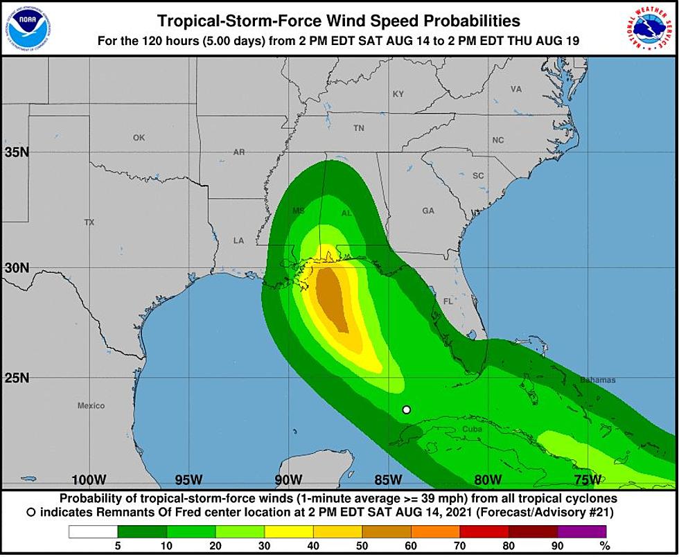
James Spann, ABC 33/40, and Townsquare Media Tuscaloosa Chief Meteorologist mentioned that for the “inland parts of Alabama, the heaviest rain should come Tuesday over the eastern half of the state, with amounts of 1-3 inches possible. Totals will be lower over the western counties of the state.” With the possible thread of heavy rains, Spann noted that “For now, the threat of significant flooding doesn’t look especially high, but a few isolated issues are possible.”
Jim Stefkovich, Meteorologist for the Alabama Emergency Management Agency, said that “wind gusts of 40-60 mph are possible over the southern half of the state, beginning near the coast Monday morning and spreading inland Monday night into Tuesday morning.”
Tropical Storm Grace
As Grace churns along its path over Hispaniola and Cuba, it could be in the Gulf of Mexico in five days. Townsquare Media is closely monitoring Grace for any possible impacts to the United States.
(Source) Click here to follow the Facebook Page for James Spann. For more from the National Weather Service Birmingham, click here. For more from the Alabama Emergency Management Agency, click here.
KEEP READING: Get answers to 51 of the most frequently asked weather questions...
LOOK: The most expensive weather and climate disasters in recent decades
TIPS: Here's how you can prepare for power outages
Ways to Receive Severe Weather Information
More From 95.3 The Bear