Possible Severe Weather Threat Kicks Off The Weekend for Central Alabama
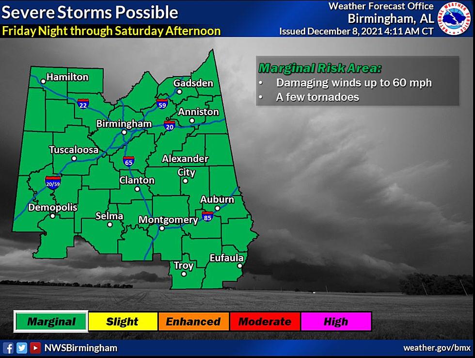
Our secondary severe weather season for our area has been pretty quiet until now. We have a cold front that will be moving through the state later this week. According to the National Weather Service in Birmingham this “will support scattered to widespread showers and thunderstorms, some storms may be severe” for all of Central Alabama.

Risk Level
Marginal for all of Central Alabama
Timeline
Friday night through Saturday afternoon
Threats:
Damaging winds to 60 mph
A few tornadoes will be possible
James Spann, ABC 33/40, and Townsquare Media Tuscaloosa Chief Meteorologist informs us that the “Storm Prediction Center (SPC), in their "Day 3" severe weather outlook which runs through 6:00 a.m. Saturday, has a "slight risk" (level 2/5) defined for the northwest corner of the state, and a "marginal risk" (level 1/5) as far south as Scottsboro and Tuscaloosa. For now, SPC has not issued a formal severe weather outlook after 6:00 a.m. Saturday in their "Day 4" outlook, but it is likely they will issue at least a marginal risk in future outlooks for most of the rest of Alabama. TIMING: The main window for strong to severe storms over the northern half of Alabama will come from 2:00 a.m. until 2:00 p.m. Saturday. After 2:00 p.m. most of the rain will shift into the southern half of the state.”
Please stay weather aware as weather information could change. We will be monitoring this system and will bring you all necessary updates leading up to the impending severe weather threat.
(Source) Click here to follow the Facebook Page for James Spann. For more from the National Weather Service Birmingham, click here.
Magical Christmas Light Displays in Alabama
Alabama Towns That Would Be Ideal for Hallmark Christmas Movies
LOOK: The top holiday toys from the year you were born
CHECK THEM OUT: 100 years of Christmas toys, gifts and fads
TOP 10: The best holiday TV specials of all time, ranked
More From 95.3 The Bear