Advance Notice About Potential Severe Weather Threat in Alabama
With April unfolding in Alabama, the likelihood of severe weather increases during this spring period. The Townsquare Media Weather Center is monitoring the potential for multiple waves of rain and active weather toward midweek.

Incoming Torrential Downpours Outlook
Areas in the far south and southeast Alabama should be aware of the potential rainfall amounts from 4 to 6 inches. This influx of rain could trigger localized flooding in urban and poor drainage areas.
The timing for the influx of wet weather is from “Tuesday evening through Thursday morning,” said the National Weather Service in Birmingham.
Preliminary Severe Weather Outlook
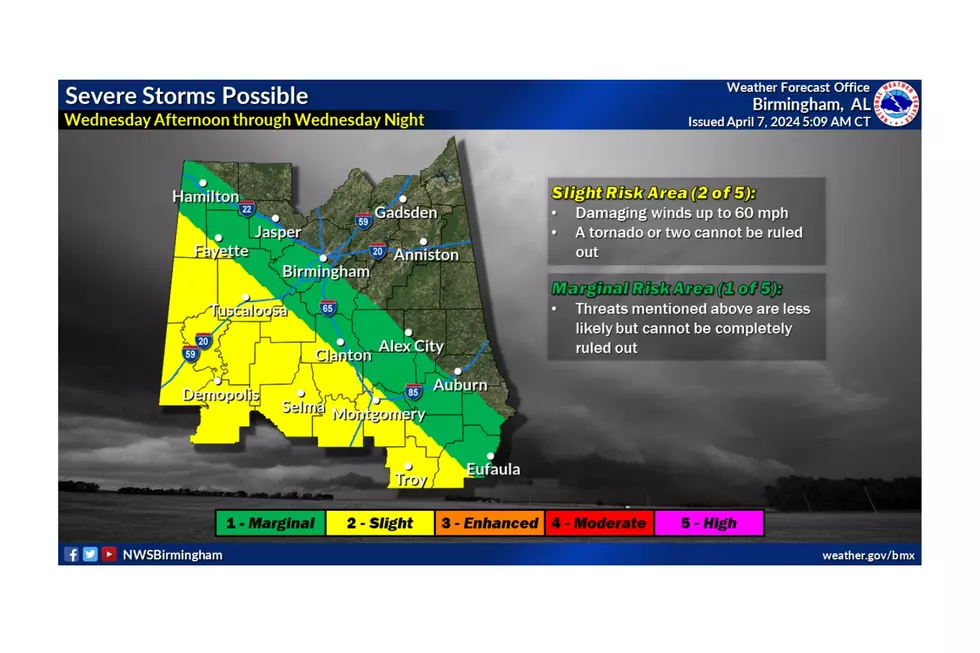
There is a concern for severe weather in the southwest half of Central Alabama. The current time of this active weather is Wednesday afternoon through Wednesday night.
The National Weather Service in Birmingham said the main threats are “damaging winds up to 60 mph and a tornado or two, which cannot be ruled out.”
James Spann, ABC 33/40, and Townsquare Media Tuscaloosa Chief Meteorologist, said “Thankfully, there will be a very limited amount of surface-based instability available, which should limit any severe thunderstorm threat.”
However, the Storm Prediction Center “has about the southwest half of Alabama in a risk Wednesday and Wednesday night. We always have to watch any dynamic system in April closely,” said Spann.
As weather conditions develop, this could change the timing, threat areas, and risks. We will be sure to keep you updated.
Unique Architectural Beauty on Lake Tuscaloosa Hits the Market
Gallery Credit: Mary K
Alabama's Most Expensive Estate Includes Elite Lakes, Trophy Hunting
Gallery Credit: Mary K
One of Alabama’s Most Expensive Historic Homes Sits on Mobile Bay
Gallery Credit: Mary K
Introducing a Stunning Property Featuring Impeccable Gardens in Tuscaloosa
Gallery Credit: Mary K
More From 95.3 The Bear


