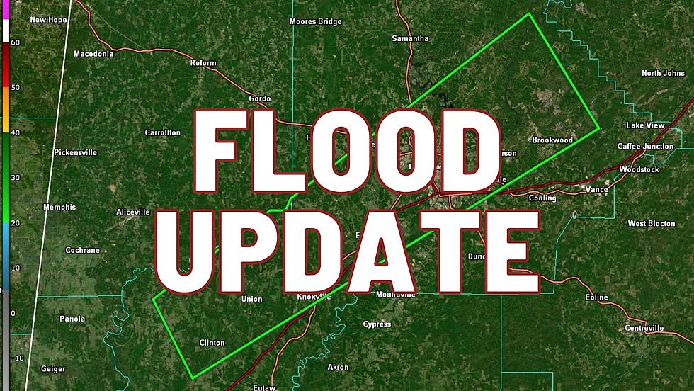
Update: NWS Increases Flash Flood Warning, ‘Life-Threatening’ Conditions Possible
UPDATE: The National Weather Service in Birmingham has increased the intensity of its current Flash Flood Warning, affecting Tuscaloosa and Greene Counties.
The current warning, now upgraded to 'considerable,' is set to expire at 11:45 p.m.
Life-threatening flooding occurring all over Tuscaloosa and Northport, and public safety officials are urging all drivers to stay off roads in the area.
The NWS urges residents in these areas to stay home and get elevated. If you are on the road and you see a body of water: turn around, don't drown.
The National Weather Service in Birmingham has issued a Flash Flood Warning for Tuscaloosa and Greene Counties.
This warning will expire at 11:45 p.m., pending any extensions.
The text of the warning is as follows:
The National Weather Service in Birmingham has issued a

* Flash Flood Warning for...
  Northern Greene County in west central Alabama...
  Southern Tuscaloosa County in west central Alabama...

* Until 945 PM CDT.

* At 639 PM CDT, Doppler radar indicated thunderstorms producing
  heavy rain across the warned area. Between 2 and 3 inches of rain
  have fallen. Additional rainfall amounts of 1 to 3 inches are
  possible in the warned area. Flash flooding is ongoing or expected
  to begin shortly.

  HAZARD...Flash flooding caused by thunderstorms.

  SOURCE...Radar.

  IMPACT...Flash flooding of small creeks and streams, urban
           areas, highways, streets and underpasses as well as
           other poor drainage and low-lying areas.

* Some locations that will experience flash flooding include...
  Tuscaloosa, Northport, Holt, Brookwood, Coker, Union, Tuscaloosa
  Regional Airport, Tuscaloosa Amphitheater, Shelton State Community
  College, Bryant Denny Stadium, McFarland Mall, University Mall,
  Jena, Knoxville, Deerlick Creek Campgrounds, Mantua, Bankhead Lock
  And Dam, Fosters Boat Landing, Palmore Park and Fosters.

PRECAUTIONARY/PREPAREDNESS ACTIONS...

Turn around, don`t drown when encountering flooded roads. Most flood
deaths occur in vehicles.
Townsquare Media Tuscaloosa's Operation Storm Watch is brought to you by Safe-T Shelter. Visit their website here to see their selection of residential and commercial safe rooms and storm shelters. To contact a Safe-T Shelter representative, click here to visit their Facebook page.

Check out the latest radar models here:
If a tornado warning is issued in our area, Townsquare Media Tuscaloosa Operation Storm Watch will provide you with live and local team coverage, including wall-to-wall weather with James Spann.
To view the latest weather updates and information, click here.
TIPS: Here’s how you can prepare for power outages
KEEP READING: What to do after a tornado strikes
KEEP READING: Get answers to 51 of the most frequently asked weather questions...
More From 95.3 The Bear