Enhanced Severe Weather Risk for Central Alabama on Tuesday
A cold front moves across the central United States today, moving towards the East by Wednesday. There is a concern for severe weather from the Southern Plains to the Mid-South, which will move towards the Southeast.
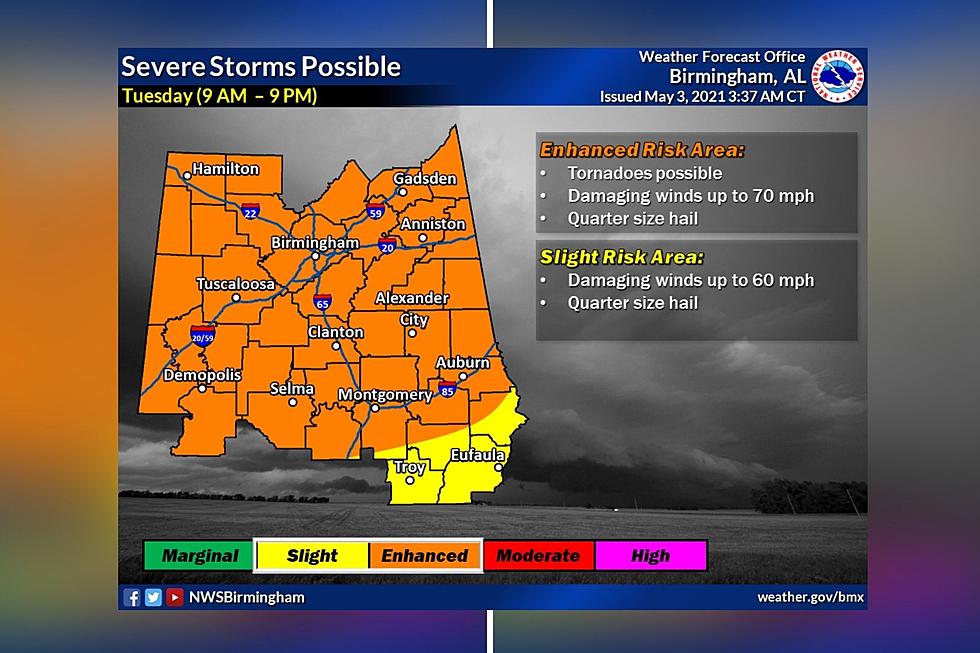
The National Weather Service in Birmingham has our coverage areas under a Hazardous Weather Outlook for Tuesday, May 4, 2021. There is a probability of strong to severe thunderstorms for Tuesday and Tuesday evenings across all of Central Alabama.
There is an ENHANCED RISK threat for all of our listening areas. The threats for this zone will include:
Possible Tornadoes
Damaging Winds up to 70 miles per hour
Quarter Sized Hail
Please stay weather aware. At the time of this publication, the current timeframe for the potential of these storms will be from 9 am until 9 pm. This could change, and we will bring you updates as necessary.

James Spann, ABC 33/40, and Townsquare Media Tuscaloosa Chief Meteorologist shares with us that the “air will become very unstable tomorrow afternoon across Alabama, and with an approaching upper trough and cold front, numerous showers and storms will form by mid to late afternoon, continuing tomorrow night. These storms will be capable of producing large hail, damaging winds, and a few tornadoes.”
Also, there is a concern for flash flooding issues with our areas that flood-prone. This is due to the possibility of heavy rains and previous saturation. Please be mindful of this if you live or work in flood-prone areas.
(Source) Click here to follow the Facebook Page for James Spann. For more from the National Weather Service Birmingham, click here.
KEEP READING: What to do after a tornado strikes
TIPS: Here's how you can prepare for power outages
More From 95.3 The Bear