![Major Winter Storm to Impact Alabama; Winter Storm Watch Now in Effect [UPDATED]](http://townsquare.media/site/530/files/2014/02/NWS-Forecast.gif?w=980&q=75)
Major Winter Storm to Impact Alabama; Winter Storm Watch Now in Effect [UPDATED]
Tuscaloosa could see up to 1/4 of ice and freezing rain as a major winter storm makes its way across the state late Monday and early Tuesday. The latest forecast also calls for up to an inch of snow.
The National Weather Service in Birmingham has issued a Winter Storm Watch for North Alabama in effect from Monday afternoon until Tuesday morning in advance of the storm.
The watch was issued for areas generally along and north of I-20. The watch includes Tuscaloosa, Birmingham, Anniston, and the rest of North Alabama. Snow and sleet will create dangerous conditions on roadways, and freezing rain or ice has the potential to down trees and create power outages.
The images below from the National Weather Service in Birmingham show how much snow and ice is expected to accumulate across the state.
The NWS Birmingham posted the following update on their official Facebook page at 7:35pm Sunday night:
* Monday's weather will be fine through at least 3 pm for the vast majority of central Alabama. Folks up around Hamilton and Haleyville may want to check the latest radar loops early in the morning, as there may be a few spots of very light freezing rain. Otherwise, temperatures will be above freezing into the afternoon hours.
* After 3 pm, temperatures will start to drop right about the same time precipitation starts to invade the area. We think the bulk of the precipitation will not arrive until after 6 or 8 pm. However, there's always a chance that some patchy stuff could come in earlier.
* Here's where the tricky part of the forecast comes. Conditions will become increasingly cold and increasingly wet as we transition into Monday night, especially after midnight. The farther north you are, the more likely you are to experience snow. The farther south you are, the more likely you are to experience a cold rain. In between, anything is possible, including sleet and freezing rain.
* Unfortunately, it looks like that potentially icy transition zone between the snow and the rain will cut right across north central Alabama. Based on all the latest computer model data, the cities of Tuscaloosa, Birmingham, and Anniston, and all areas within about 50 miles of those cities will potentially be in that transition zone at some point between midnight and noon on Tuesday.
* There's a chance this could turn into a prolonged winter weather event, as recent computer model runs indicate another disturbance could bring a second round of precipitation to the state Tuesday night and into Wednesday.
* Very small variations in temperatures (which are difficult to model) could lead to significant differences in precipitation type. Boundaries between snow, sleet, freezing rain, and rain areas rarely follow straight lines or gentle curves (even though that's frequently how there are depicted on forecasts).
* A Winter Storm Watch has been posted for areas we currently think stand the best chance of getting significant accumulations of snow and/or ice (see the previous two posts).
IMPACTS:
* Driving conditions could become quite hazardous Monday night into early Tuesday, especially in areas that receive heavier snow or freezing rain.
* With the threat of freezing rain, there is a chance that some spots may lose power as trees and power lines accumulate ice.
ABC 33/40 Chief Meteorologist James Spann wrote about the impending winter weather threat on www.alabamawx.com:
"*TIMING: The main initial impact will come from 6:00 p.m. tomorrow through 12:00 p.m. Tuesday. There is some risk wintry precipitation could begin over far North and Northwest Alabama as early as 3:00 p.m. tomorrow. And, the far northern part of Alabama could have ice impacts through the afternoon Tuesday.
*IMPACT: Ice accumulation of 1/4 inch is possible along the I-20 corridor; this could lead to scattered power outages. Should the ice load be greater than forecast, outages could more widespread and last longer.
Travel will become difficult along and north of I-20. Initially, bridges and overpasses will become icy, road surfaces will become slick and dangerous later.
*PLACEMENT: Scroll down for the impact maps. Clearly the big issues will be along and north of I-20. The southern periphery of the ice zone is very hard to call. Some parts of Tuscaloosa, Birmingham, and Anniston could very well get away with a cold rain, while other parts of these cities could have enough ice for major travel impact. Snow is most likely along and north of U.S. 278 (Hamilton to Cullman to Gadsden)."
With a serious winter weather threat ahead, now is the time to prepare. Make sure you and your family have an alternate heat source should the power go out at your house; stock up on firewood or fuel for kerosene heaters. In addition to staples like bread and milk, make sure your family has a manual can opener, batteries for radios and flashlights, and a few gallons of water should the pipes freeze at your home.
More From 95.3 The Bear
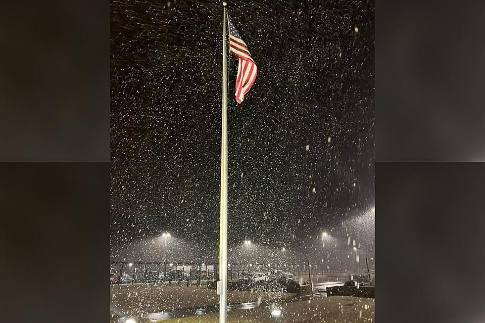
![[Pictures] Alabama Kicks off New Year In a Winter Wonderland](http://townsquare.media/site/962/files/2022/01/attachment-271313850_10223388954365375_6280379482093620134_n.jpg?w=980&q=75)


![Snowstorm Possible in Tuscaloosa Tuesday [VIDEO]](http://townsquare.media/site/530/files/2019/01/Tuesday-Snow.png?w=980&q=75)
![Snow Falls in East Tuscaloosa and Cottondale [VIDEO]](http://townsquare.media/site/530/files/2017/01/Snow-Bird.jpg?w=980&q=75)
