Severe Storms, Tornadoes Possible in Alabama Tomorrow
Severe storms are likely in Alabama tomorrow as a cold front makes its way across the state, and West Alabama may be at a greater risk for tornadoes and damaging winds.
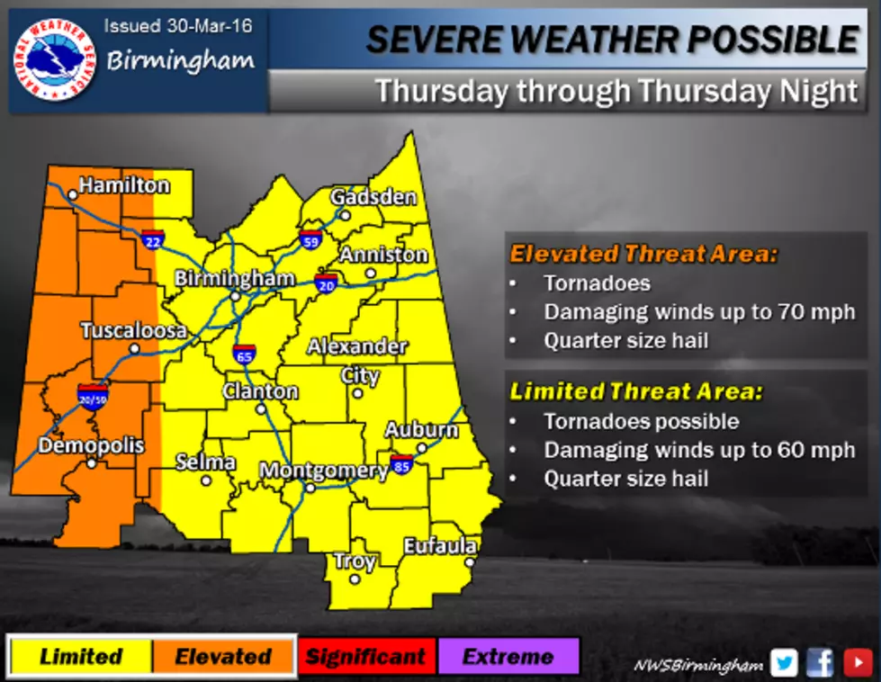
The National Weather Service in Birmingham has most of the state under a limited risk area for tomorrow's storm activity; while places like Birmingham and Clanton could see strong winds and a possible tornado, the Weather Service currently believes the greatest risk for tornadoes is in West Alabama. Tuscaloosa and the Western 1/3 of the state have been placed in an elevated risk area for tomorrow--damaging winds of up to 70 MPH, quarter-size hail, and tornadoes are all possible.
ABC 33/40 Chief Meteorologist James Spann currently projects storms to impact the state between 3 p.m. and 12 midnight. Storms will develop over West Alabama first, meaning our listening area will see its greatest risk for severe weather tomorrow afternoon and evening.
In addition to severe weather, these storms are also forecast to bring heavy rain. We could see up to 2 inches of rain tomorrow afternoon and overnight; this can create flash flooding issues.
More From 95.3 The Bear