Potential for a Severe Weather Outbreak Tuesday in Tuscaloosa
With looming weather issues Tuesday, it's important to point out there are no severe weather threats Monday but may see widely scattered light showers late this afternoon.
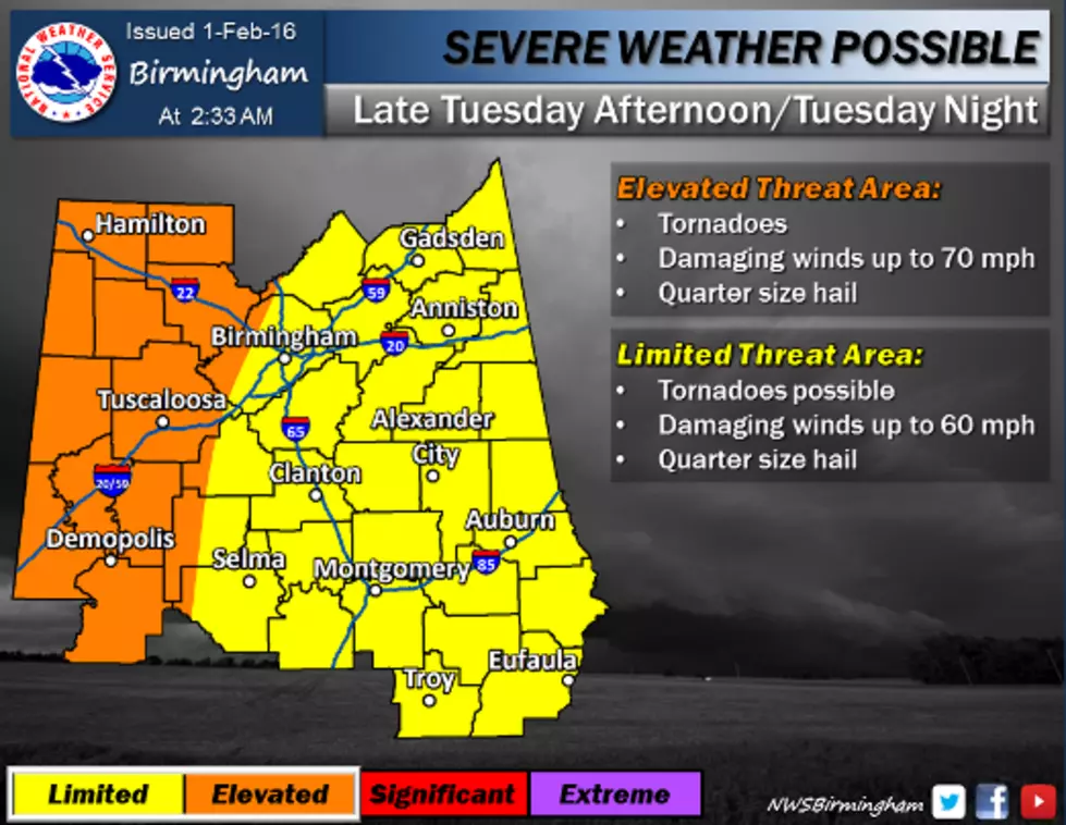
According to Tuscaloosa EMA,
Severe weather, including tornadoes and damaging winds appear possible across Central Alabama late Tuesday afternoon into Tuesday night. At this time, there is a greater severe threat across the western counties as the Enhanced Threat area has extended further eastward. A tornado watch could be issued as early as 2:00 or 3:00 PM. Prime time for severe weather is 3:00 to 8:00 PM but storms should exit area by mindnight. Rainfall levels of 1” to 2” are possible. There could be some localized flash flooding with this system as it moves through the area.
Gusty winds of around 35 mph are possible outside the rain areas Tuesday and Tuesday night.
Keep it tuned to our Townsquare Media Tuscaloosa group of radio stations for frequent updates should severe weather strike.
More From 95.3 The Bear